What is the PPP?
Min Chen, Tersus GNSS 24 April, 2023
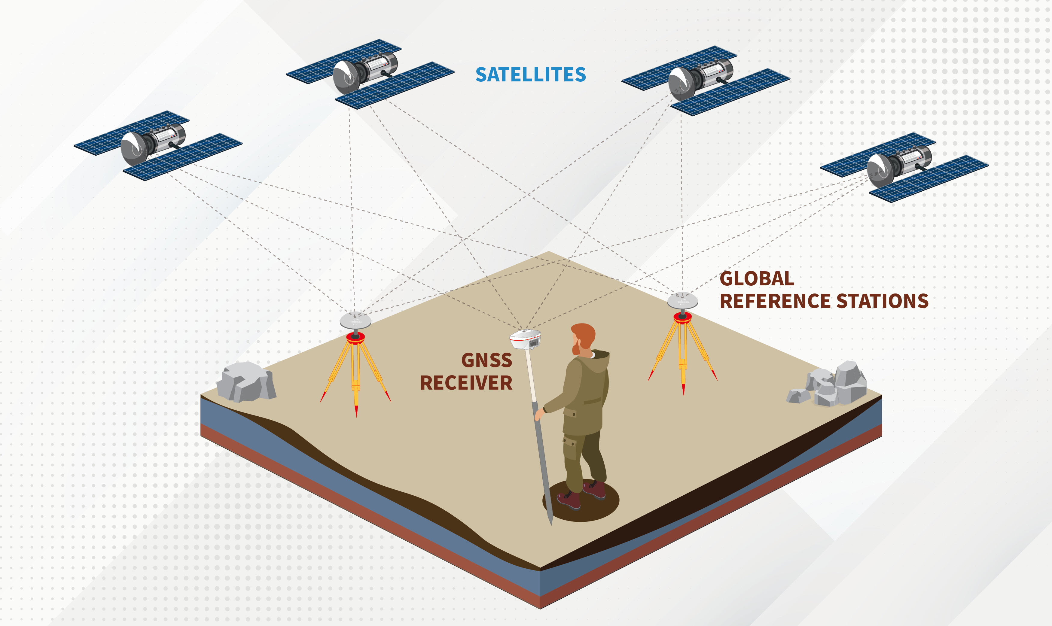
PPP means Precise Point Positioning. It refers to the technology in which the server makes use of global or regional reference stations to make a real-time estimation of satellite orbit errors, clock errors, etc., and directly broadcast to the end user via satellite or over the internet. The user can achieve global high-precision absolute positioning by using a single GNSS receiver. This positioning technique is widely used in robotics, autonomous navigation, agriculture, construction, mining and where centimeter-scale precision is generally needed.

The traditional single point positioning (SPP) uses pseudo range observations (C/A code or P code) for positioning, generally can only reach the accuracy of meters or even worse, can not achieve high precision positioning. Precision point positioning technology, using precise satellite orbit and precise satellite clock correction, as well as the non-differential carrier phase observation data of a single receiver for single point positioning, can obtain centimeter-level positioning accuracy.
Compared with RTK technology, which can also achieve centimeter-level high-precision positioning, PPP has two main advantages: first, it makes the client system more simplified and does not need to set up a base station on site or use network CORS service; Second, it can maintain global consistency in positioning accuracy.
Precise point positioning technology was born in the 1990s, when the United States Jet Propulsion Laboratory (JPL) in the processing and analysis of IGS(International GNSS Service) data, this technology was proposed for non-core IGS station data processing. The idea of this technology is as follows: in GNSS positioning, there are mainly three kinds of error sources: orbit error, satellite clock error and ionospheric delay. If a dual-frequency receiver is used, the ionospheric delay can be corrected by combining observations of different frequencies.
If the Earth Centered Earth Fixed(ECEF) coordinate system is used to represent the satellite orbit, the calculated reference frame is also ECEF coordinate system, and the earth rotation parameter in the observation equation can be eliminated. Therefore, as long as the orbit and precise satellite clock error are given, a precise observation model are using, the precise position, clock offset, ambiguity and tropospheric delay parameters of the receiver can be calculated by a single station.

The accuracy of the PPP
The theoretical accuracy of PPP can be centimeter-level, but it takes a period of convergence to achieve this accuracy. The actual accuracy of PPP is related to the following factors:
1. Convergence time
2. the quality of correction data the satellites broadcast.
3. Surrounding environment of receiver, whether there is occlusion and multipath effect, etc
4. PPP Filter Algorithms
TAP(Tersus Advanced Positioning) is a satellite-based precise point positioning service developed by Tersus GNSS, which allows users to achieve centimeter-level high-precision positioning worldwide. With TAP , the GNSS rover receiver will not need to work with the local RTK base station or CORS but directly receives corrections broadcast by the satellites, such as ephemeris error, satellite clock error, etc.
TAP meets the demand for centimeter-level high-precision positioning in areas without or with poor network coverage, such as oceans, deserts, mountains, high altitudes, etc.
Key Features of the TAP:
1. With worldwide coverage, it can be used as long as there is a good vision.
2. No need to use the network to receive corrections.
3. Broadcasting over the internet is available as a backup method for data delivery for all users.
4. High signal stability, which guarantees uninterrupted transmission for 24 hours a day.
5. It can be widely used in autonomous driving, precision agriculture, disaster monitoring and so on.
Technical Specifications contain the following:
1. Signal tracking: GPS, GLONASS, BeiDou, Galileo
2. Accuracy (RMS):<5cm
3. Convergence time: 15 minutes
4. Coverage: Global
5. Signal stability: 99.99%
Of course, PPP also has certain limitations, such as a long convergence time. In recent years, PPP-RTK technology is also developing rapidly. PPP-RTK technology is a combination of PPP and RTK. It absorbs the advantages of RTK and PPP, and overcomes the limitations of traditional RTK technology, such as the requirement of Internet or radio communication, and the obstacle of too long convergence time of PPP technology. It also has the advantages of both in practical application and can provide fast convergence and high-precision positioning services worldwide.
About Tersus GNSS Inc.
Tersus GNSS is a leading Global Navigation Satellite System (GNSS) solution provider. Our offerings and services aim to make centimeter-precision positioning affordable for large-scale deployment.
Founded in 2014, we have been pioneers in design and development GNSS RTK products to better cater to the industry’s needs. Our portfolios cover GNSS RTK & PPK OEM boards, David GNSS Receiver, Oscar GNSS Receiver, MatrixRTK [GNSS CORS Systems] and inertial navigation systems.
Designed for ease of use, our solutions support multi-GNSS and provide flexible interfaces for a variety of applications, such as UAVs, surveying, mapping, precision agriculture, lane-level navigation, construction engineering, and deformation monitoring.
Sales inquiry: sales@tersus-gnss.com
Technical support: support@tersus-gnss.com
