What’s single-beam bathmetry?
Min Chen, Tersus GNSS 18 April. 2024
What’s single-beam bathmetry?
1. Definitions
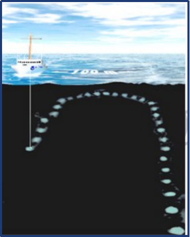
Bathymetric surveys are a type of hydrographic survey which map out the details of underwater terrain, illustrating the depth and land that lies beneath a body of water. Depending on the measuring tools used, the main methods used for bathymetry are: sounding pole and hand lead line, single-beam bathymetry, multibeam bathymetry, and so on.

Sounding pole and hand lead line were the early tools of bathymetry. This method, while the measured depth data may be accurate, is inefficient and provides insufficient coverage between single measurement. However, they are still playing an important role in areas where sonar equipment does not work, such as dense aquatic grass or shallow.

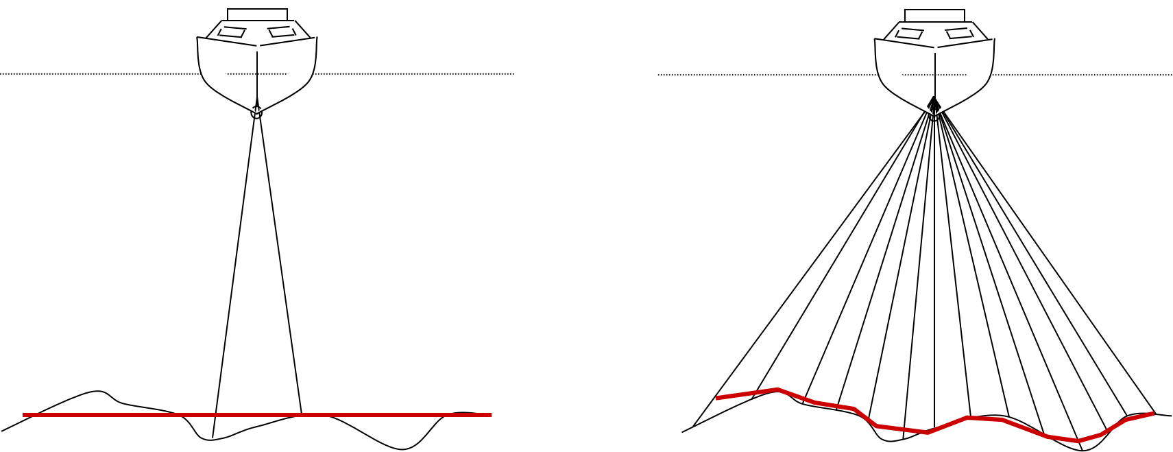
Single-beam bathymetry and multibeam bathymetry both belong to sonar bathymetry, and they greatly improve the accuracy and efficiency of bathymetry. Compared with single-beam sounder, multibeam sounder has the characteristics of high measurement accuracy, high resolution and high measurement efficiency, but it is expensive, so in practice, the use of single-beam sounder is still the mainstream.

2. Principle of single-beam echo sounder:
The bathymetric process of a single-beam echo sounder uses a transducer to emit short pulses of acoustic waves vertically downward, and when this pulsed acoustic wave encounters the seafloor it is reflected, and the reflected echoes are returned to the sonar and received by the transducer. The bathymetric value is determined by the two-way travel time between the sound waves on the seafloor and the average speed of sound in the aqueous medium.
D is the distance between the transducer and the seafloor; C is the average speed of sound in the water column; and T is the two-way travel time of the sound wave.
3. Composition of single-beam echo sounder:
The composition of single-beam sounder is relatively simple, mainly composed of the following parts of hardware and software:
(1) GNSS positioning system;
(2) Single-beam echo sounder;
(3) Control, data acquisition and processing system.
4. Single-beam USV (Unmanned surface vehicle) bathymetric system:
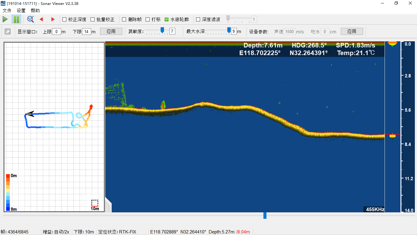
At present, the USV (Unmanned surface vehicle) system is widely used in underwater topographic survey of rivers, lakes and reservoirs for its lightweight, efficient and intelligent features. Its working principle is that the USV is equipped with a variety of high-precision sensing equipment and collaborative operation, in which the GNSS equipment can make the USV travel at a uniform speed on the designed route; the depth measurement system such as single-beam bathymetry can carry out water depth measurement according to a set spacing or time interval with the assistance of the GNSS positioning system. With the assistance of GNSS positioning system, single-beam echo sounder can measure the water depth according to the set spacing or time interval, and at the same time obtain the horizontal coordinates of the measurement point; the IMU is used to obtain the attitude of the USV during the bathymetry, and transmit the positioning data, bathymetry data, and attitude data in real time through the communication equipment to the data center, so that the technician can see the data collection situation in real time on the remote control and the computer.

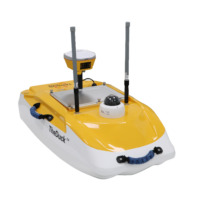
Tersus TheDuck™— An efficient and productive unmanned surface vessel equipped with a single-beam echo sounder.
Tersus TheDuck™ represents a smart, efficient, and productive unmanned surface vessel equipped with a single-beam echo sounder. It provides a fast, dependable, and portable solution to perform bathymetric surveys in various environments, such as rivers, lakes, reservoirs, and coastal areas. With its advanced capabilities and user-friendly design.

TheDuck™ is a powerful tool for professionals in bathymetry, offering unparalleled accuracy and precision in the collection of positioning and depth data. TheDuck™ is sure to meet your needs and exceed your expectations.
Key features:
1) TheDuck™ can be equipped with an Oscar-TAP GNSS receiver and implement the PPP function. TheDuck™ is unrivalled in rivers, lakes, and offshore areas with no or very poor network coverage.
2) Optional Echo Sounder: The built-in single-beam echo sounder is optional(100 meters@455 kHz or 300 meters@200 kHz) .
https://www.tersus-gnss.com/product/usv-theduck
About Tersus GNSS Inc.
Tersus GNSS is a leading Global Navigation Satellite System (GNSS) solution provider. Our offerings and services aim to make centimeter-precision positioning affordable for large-scale deployment.
Founded in 2014, we have been pioneers in design and development GNSS RTK products to better cater to the industry’s needs. Our portfolios cover GNSS RTK & PPK OEM boards, David GNSS Receiver, Oscar GNSS Receiver, MatrixRTK [GNSS CORS Systems] and inertial navigation systems.
Designed for ease of use, our solutions support multi-GNSS and provide flexible interfaces for a variety of applications, such as UAVs, surveying, mapping, precision agriculture, lane-level navigation, construction engineering, and deformation monitoring.
Sales inquiry: sales@tersus-gnss.com
Technical support: support@tersus-gnss.com
