
High-Performance Airborne LiDAR Mapping


3 cm / 5 cm Accuracy
Survey-grade vertical & horizontal accuracy.


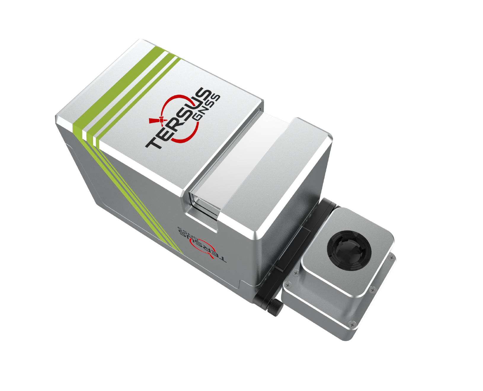
1.4 kg Lightweight
Highly integrated, all-in-one design including camera.


7 Echo Returns
Exceptional penetration through dense vegetation.


400 m Flight Height
Efficiently cover large areas with up to 400 m AGL.
Survey-Grade Accuracy
Achieve outstanding system accuracy with 3cm vertical & 5cm horizontal accuracy (@150m AGL), supported by 5mm ranging accuracy.
Exceptional Penetration
Up to 7 echo returns, easily penetrates dense vegetation to acquire ground points.
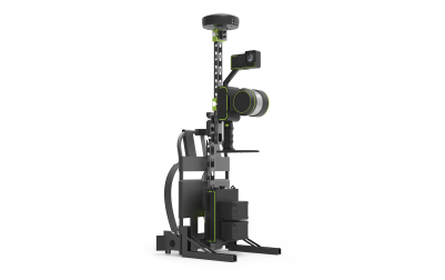
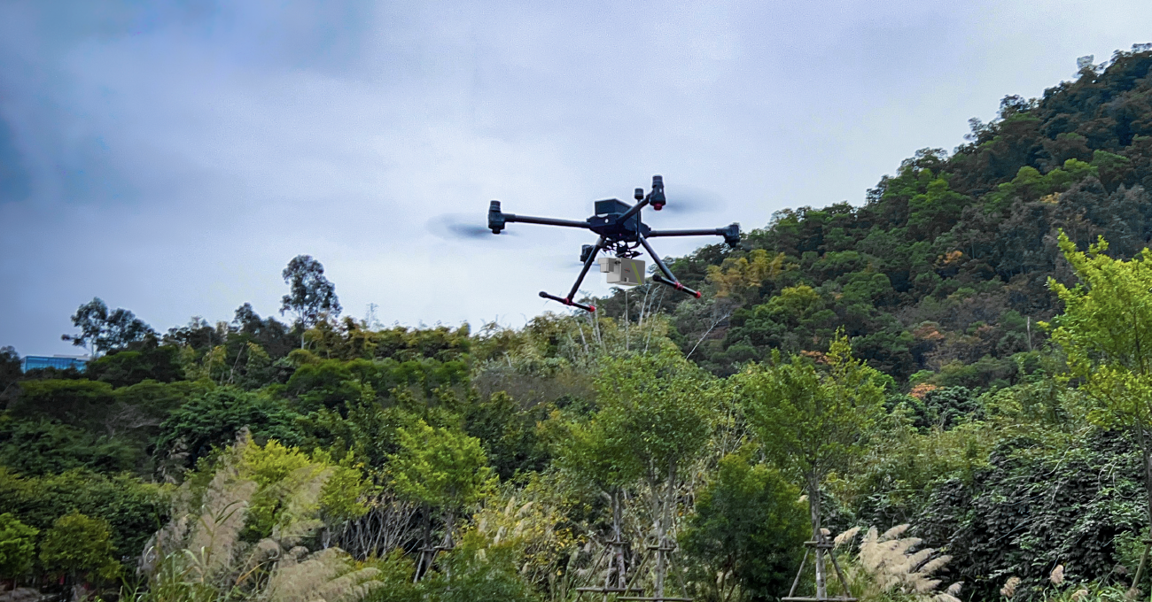
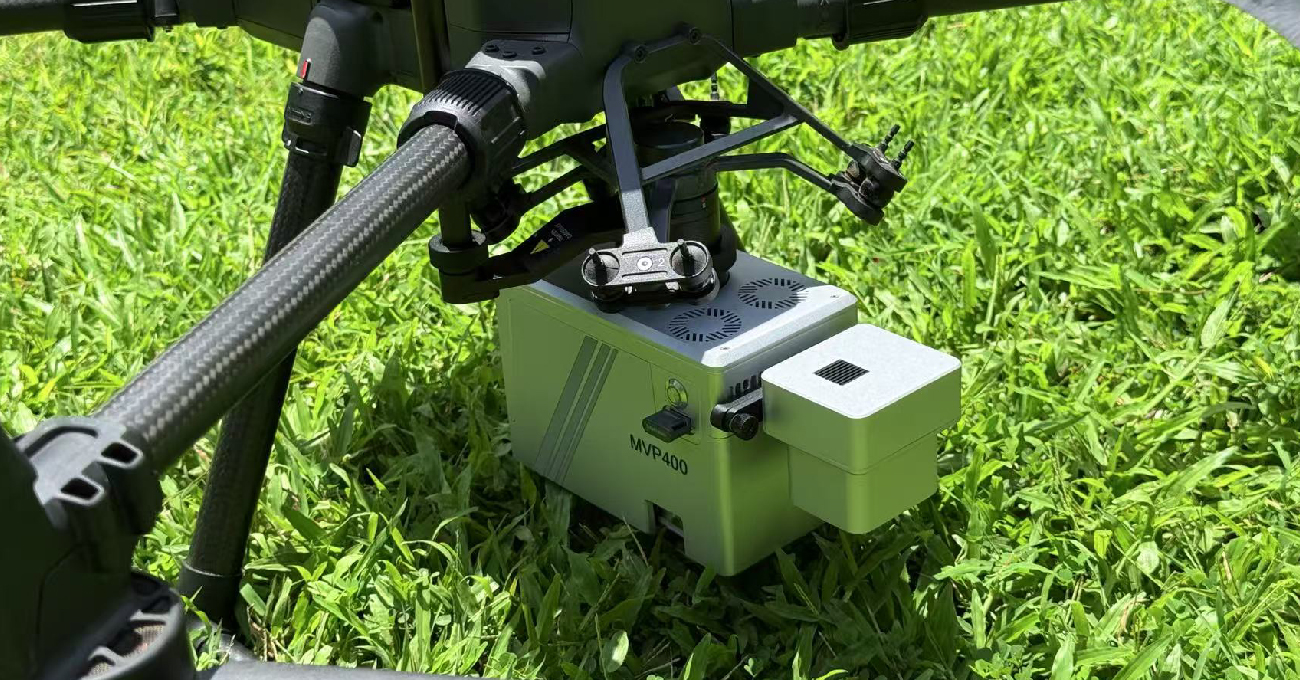
Lightweight & All-in-One
System weighs only 1.4kg with camera; LiDAR, camera, storage & DJI SkyPort in one unit.
High-Efficiency, Long-Range
Flying height up to 400m, 90° FOV, 300 lines/s scan speed.
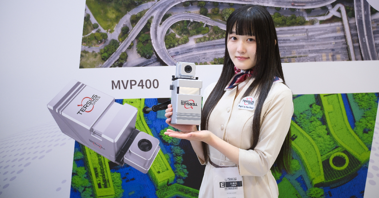
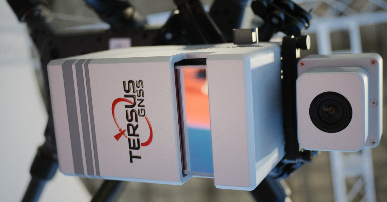
Flexible Camera Options
MVP400 with 26MP APS-C;
MVP400 Pro with 45MP Full-Frame + high-precision IMU.
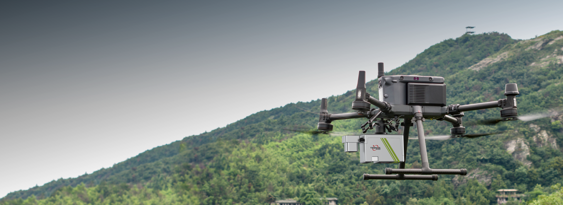
Ready to Deploy
Fully calibrated; mount via DJI SkyPort on DJI M300/M350, start mission instantly.
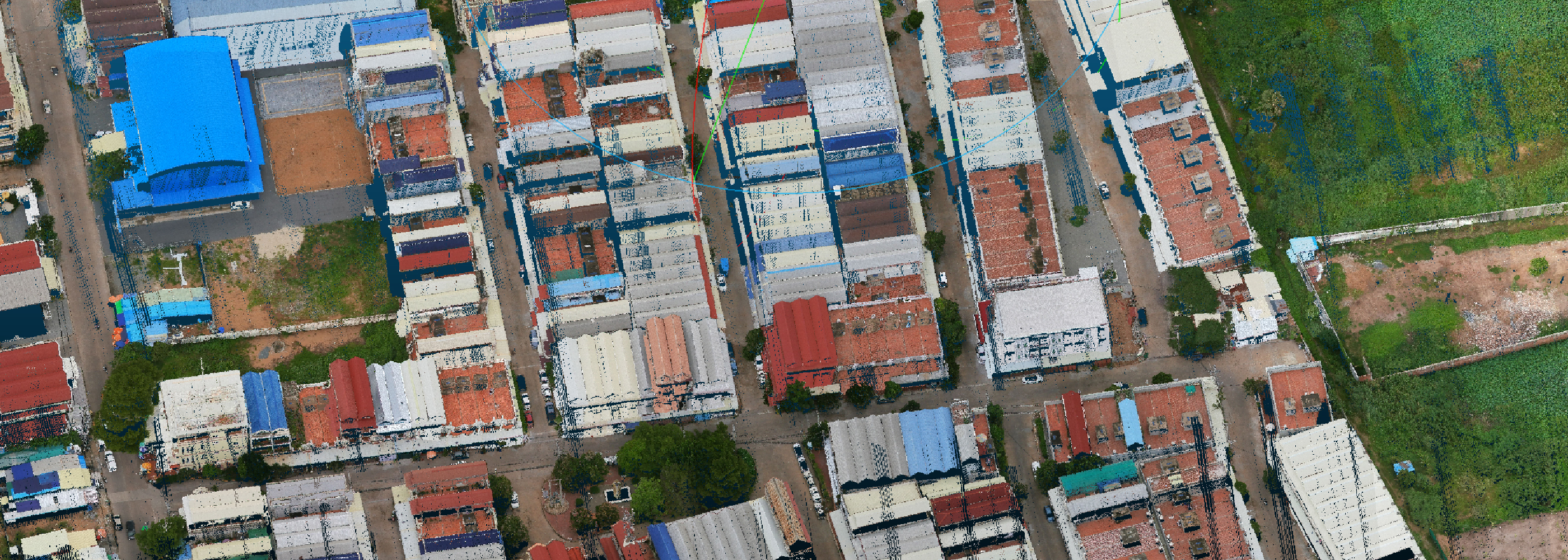
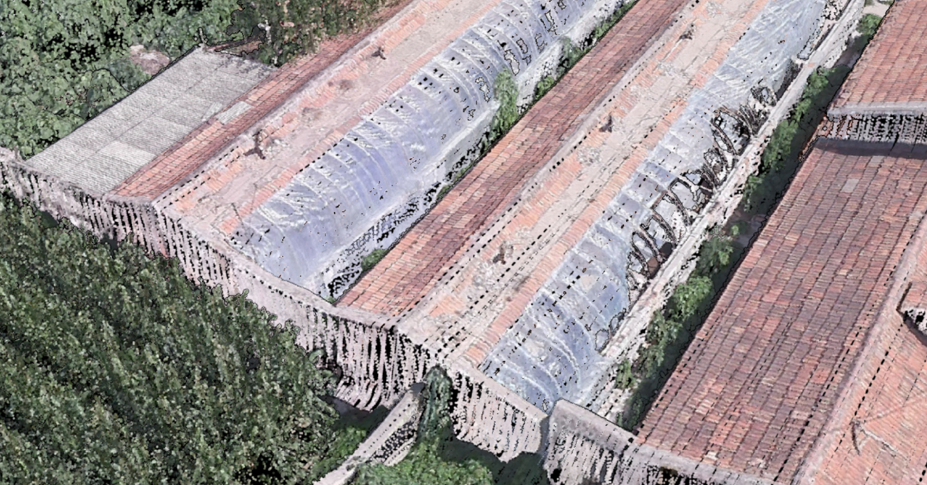
Digital models are commonly used geospatial results generated by LiDAR Mapping System. These products are widely applied in terrain mapping, monitoring and reconstruction.

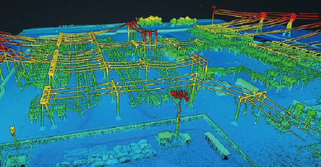
Extremely precise 3D LiDAR data for purposes like analysis of road infrastructure, locating light poles and traffic signs, new planning and asset management.
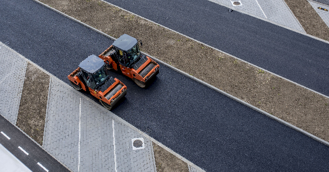
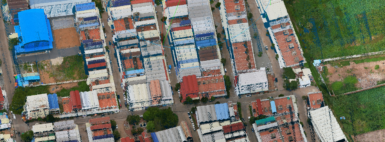
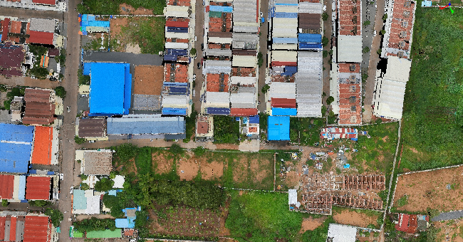
In building construction and infrastructure, MVP offers a detailed and accurate point cloud data for smart city, street mapping and BIM.
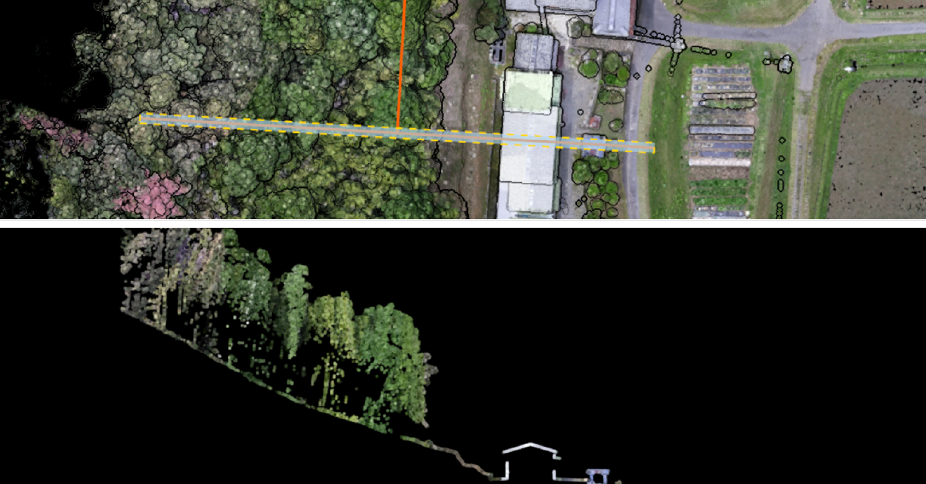
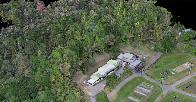
Provide detailed information on forest structures, including tree height, diameter, volume, leaf area index, etc. Also efficiently obtain under-tree ground surface information for digital models.
Efficiently acquire dense point clouds for detecting downed power lines, hazardous trees, and other potential hazards.
A Complete, Streamlined Solution
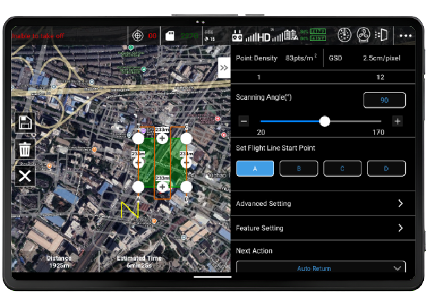
Mission Plan
MVP Pilot
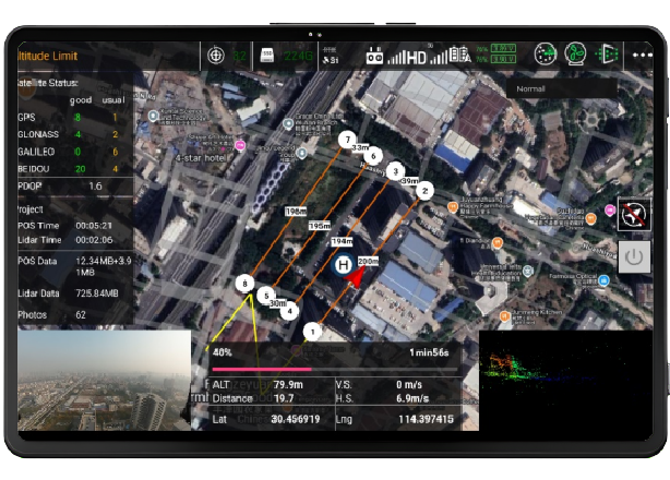
Data Collection
DJI with MVP Pilot
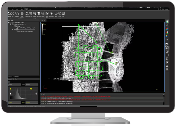
Processing
MVP studio
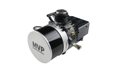
The Tersus MetaVerse Painter 400 (MVP 400) is engineered for professionals who demand both precision and efficiency. It integrates a powerful laser scanner capable of high pulse rates and multiple returns, a tightly coupled GNSS/INS navigation module, and interchangeable high-resolution cameras.
-
Datasheet_MVP400
Release Date: 2025-06-05 Version:1.6
-
Brochure_MVP400
Release Date: 2025-09-02 Version:1.2